
Do you know that sheep never shut the flock up? Not at all, not all night. Any hour of the dark is fair game if you’re a sheep. Honestly though, I didn’t mind. In such a remote location, the chatter of the sheep and the sound of the rain were a perfect white noise.
My plan today is to be in Tongariro National Park, about two hours away, at noon to start hiking since the forecast has been showing rain until noon. I was again up before 7am so I considered finding something else to do on my drive down but instead opted to have a leisurely morning and stay cozy in the little cabin as the air outside misted. I took my sweet time getting ready and doing some writing. Through the full wall of windows across from the bed I saw something small and brown bounce across the porch. WTF was that?! I rushed to the door in time to see the cutest little weasel bouncing across the grass into a bush. It didn’t run, it straight hop-bounced. I’ll have to research what this creature actually was. I didn’t have time to get a picture of it but trust me, it was freaking adorable.
Yesterday I used a small waist pack but heading into the Tongariro National Park requires a bit more preparation so I prepared my hiking pack for the day, ensuring I had all my rain layers ready to go, as I packed up. I looked at the AirBnB host book and saw that they expected guests to wash their own dishes. Here is an AirBnB gripe, don’t charge me an excessive cleaning fee if you want me to wash my own dishes by hand. I did also read some interesting history about the property in the host book. Ripples Retreat was only built in the last three years. The surrounding land is, in fact, the owners farm and they have over 4,000 sheep! During the filming of The Hobbit, the land where Ripples now stands was leased from them and used as a food hall and rest area for the cast and crew. And the Budweiser commercial that appeared in the 2018 Super Bowl was filmed here; the headboard of the bed is made from a prop. Interesting property history.
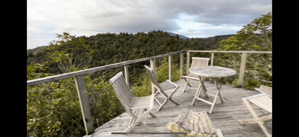
Pretty much right on time to get to the Park by noon, I hit the road. It’s a shame I didn’t get to enjoy the patio, outdoor tub, and river amenities at Ripples but oh well.
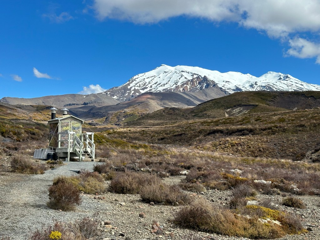
The drive to Tongariro National Park was uneventful with rain off and on every few minutes until I got within 10 minutes of the Park and it miraculously stopped. I’ve never been to this side of the park before, just west of the Tongariro Alpine crossing, and I stopped by the Visitor Center to pick up a trail map. I spoke with the rangers while I was in there about weather the next few days and am pretty bummed that they seem certain that the day after tomorrow, when I am planning to hike the Crossing again, will be the worst weather coming in the next week and the track will most likely be deemed unsafe to attempt. “It’s not looking good.” Ugh. Tomorrow is the best weather but I already have an odd excursion down to Whangamomona booked.
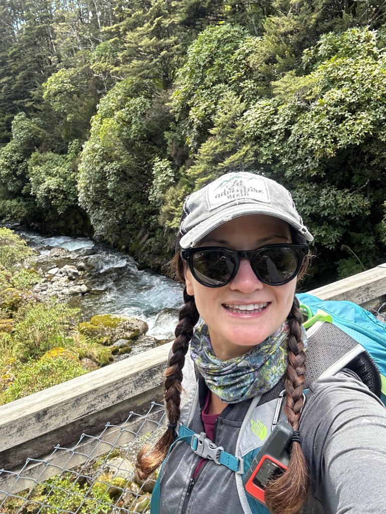
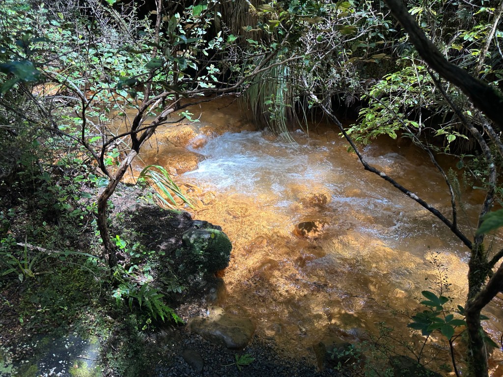
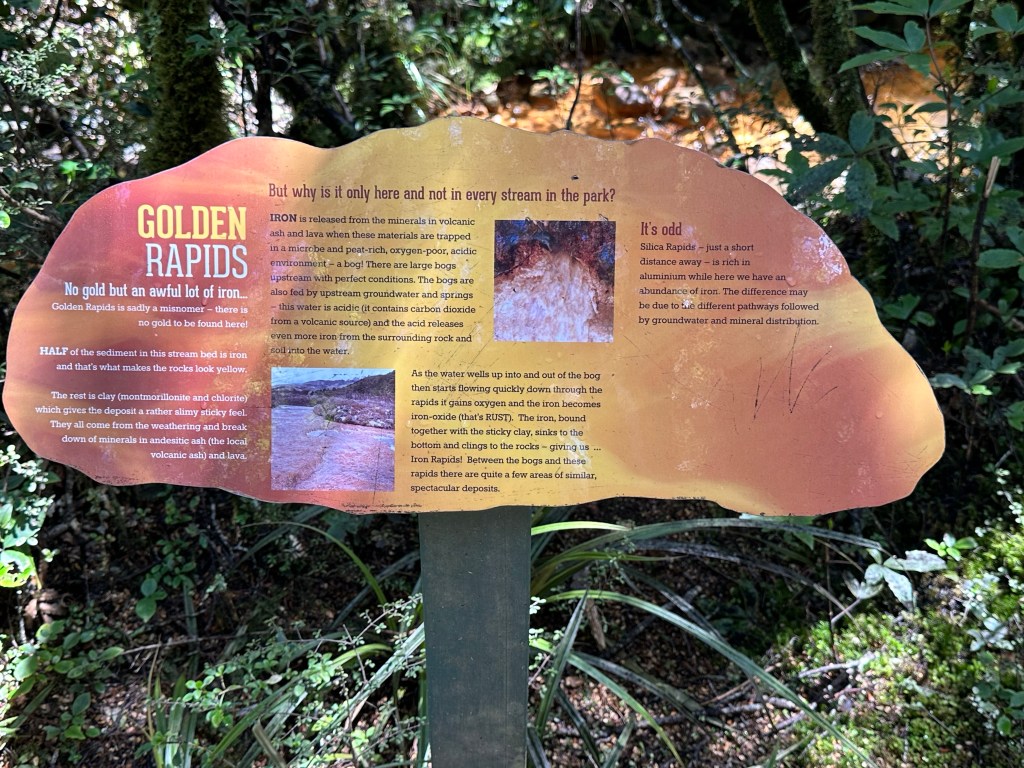
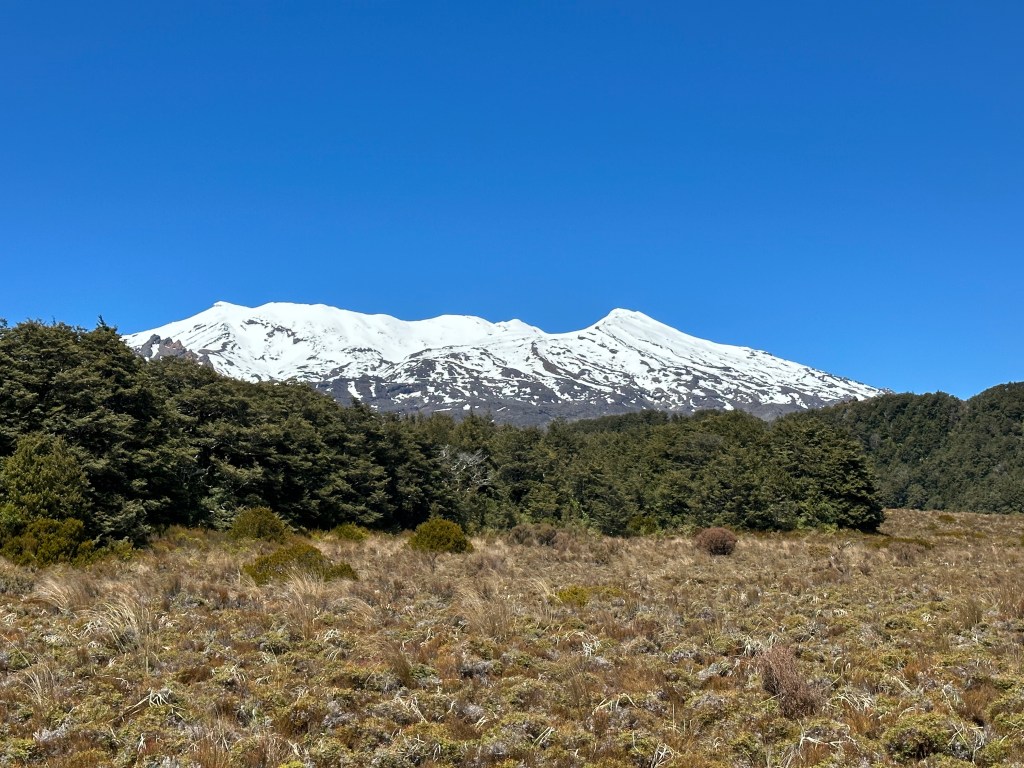
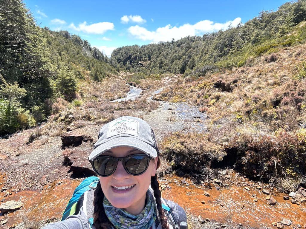
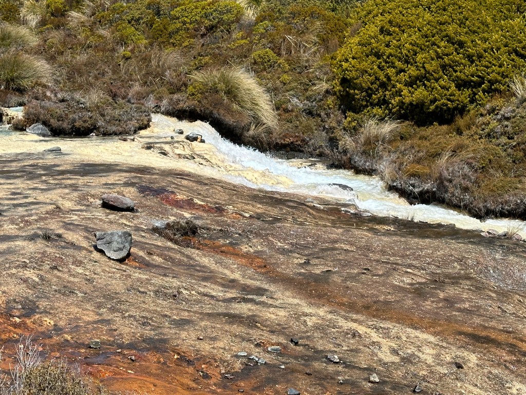
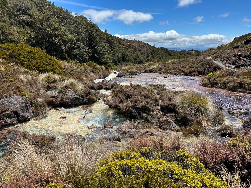
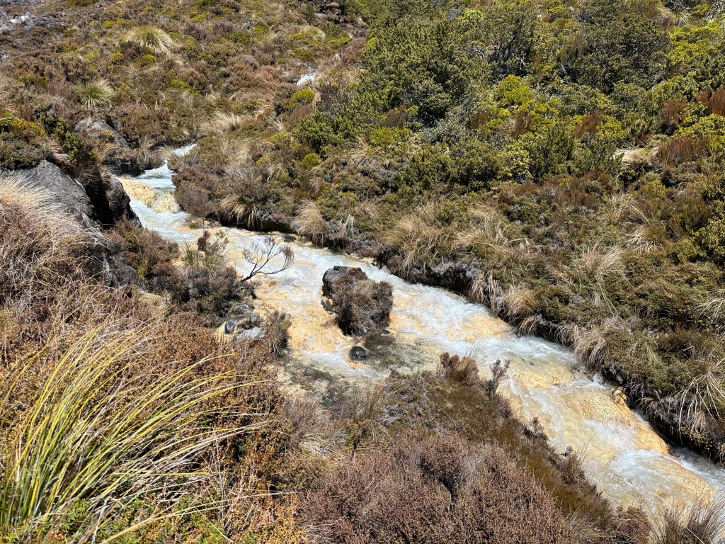
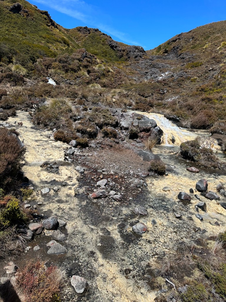
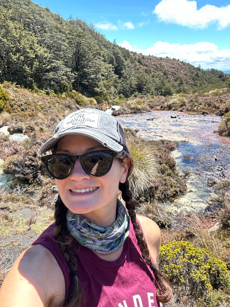
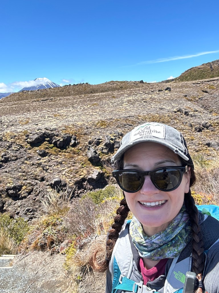
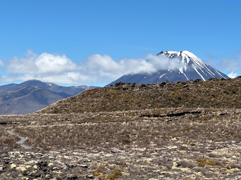
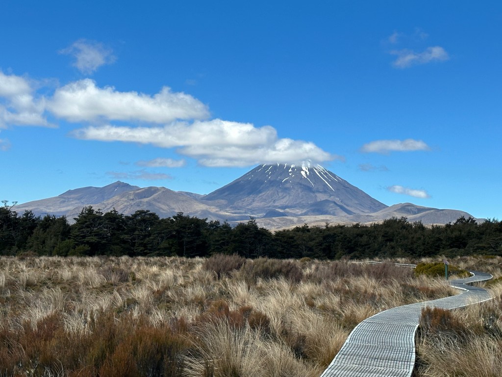
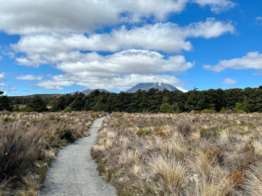
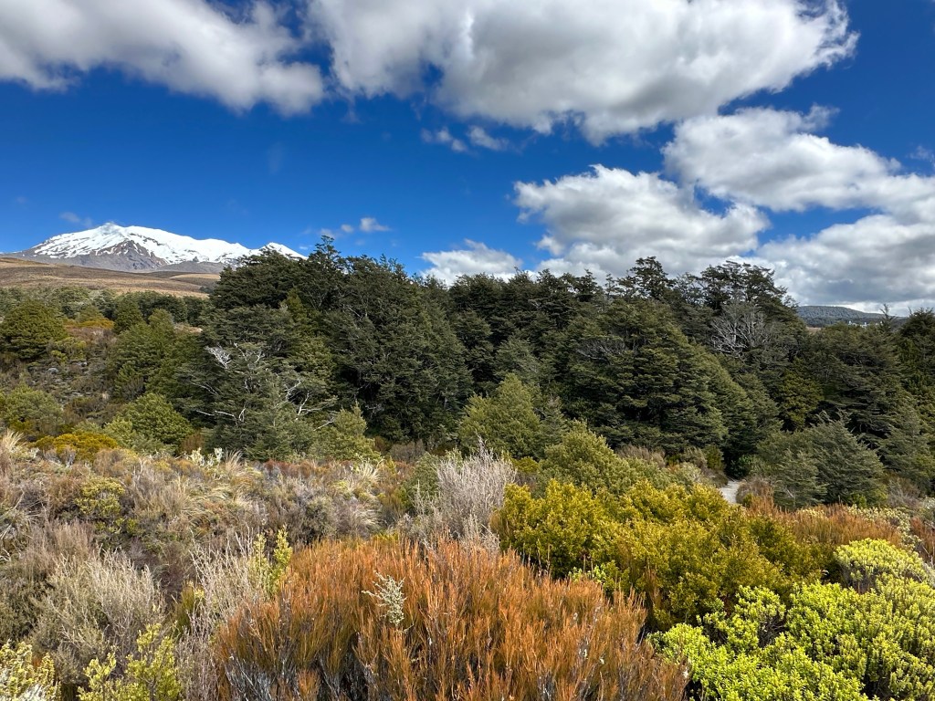
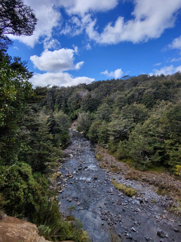
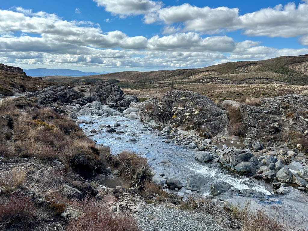
My plan was to start hiking at noon and at 11:57am I was eating my peanut butter and jelly sandwich in the parking lot before I hit the trail right on time. Love it when a self-imposed itinerary comes together. My first trail of the day is Silica Rapids, a 7km track out to, you guessed it, some silica rapids. A bright red-orange river flowed alongside the trail from the start and a sign confirmed my guess that the color was due to a high iron concentration. I love seeing the iron and signs of other minerals. We’re in volcanic territory now! Mount Ruapehu (Fun fact: I called it Mount Whakapapa in every video I mentioned it in because I had read the map wrong; it was the Whakapapa side of Ruapehu, not Mount Whakapapa) dominated the background of the landscape, covered in snow and weaving in and out of view as I wove along the track.
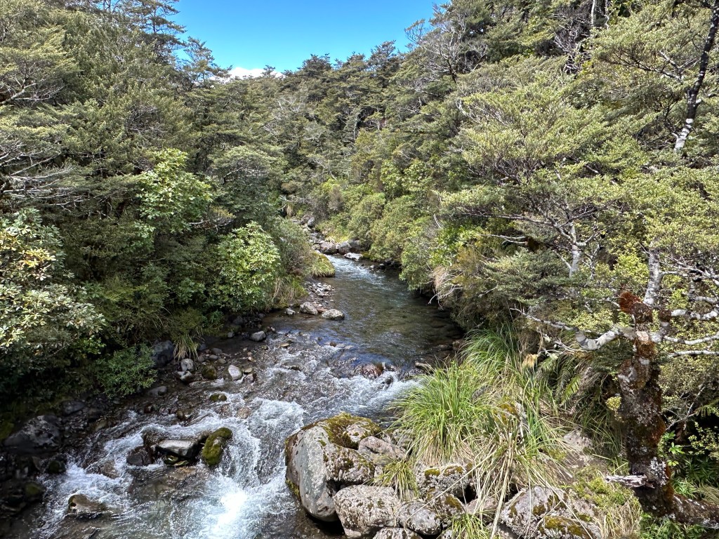

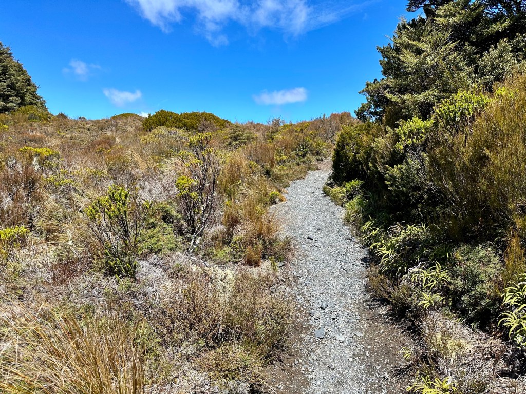
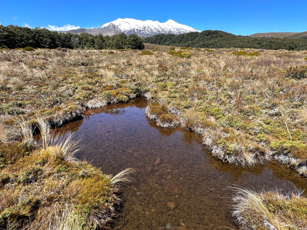
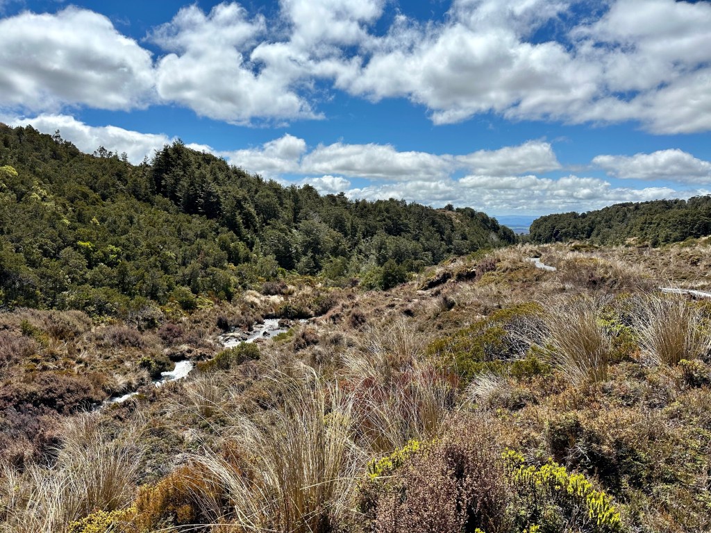
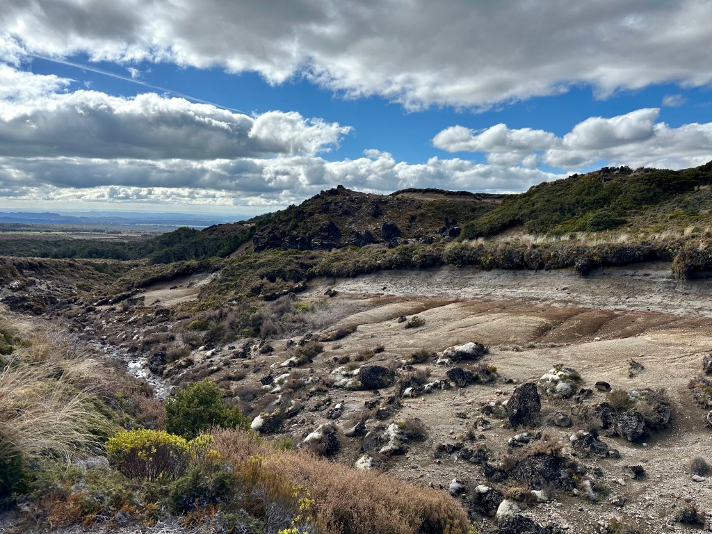
Boardwalks crossed over boggy fields of, well, bogs, between thick forest groves. Bridges crossed back and forth up river where the water hadn’t passed the bogs yet and didn’t have the iron tinge. I reflected on my disappointment over the Tongariro Alpine Crossing likely being unpassable and came to peace with it. If I can’t do the Crossing it just means that it wasn’t meant to be this time.
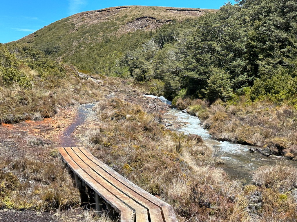
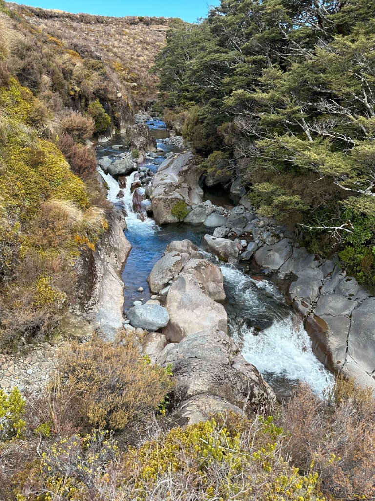
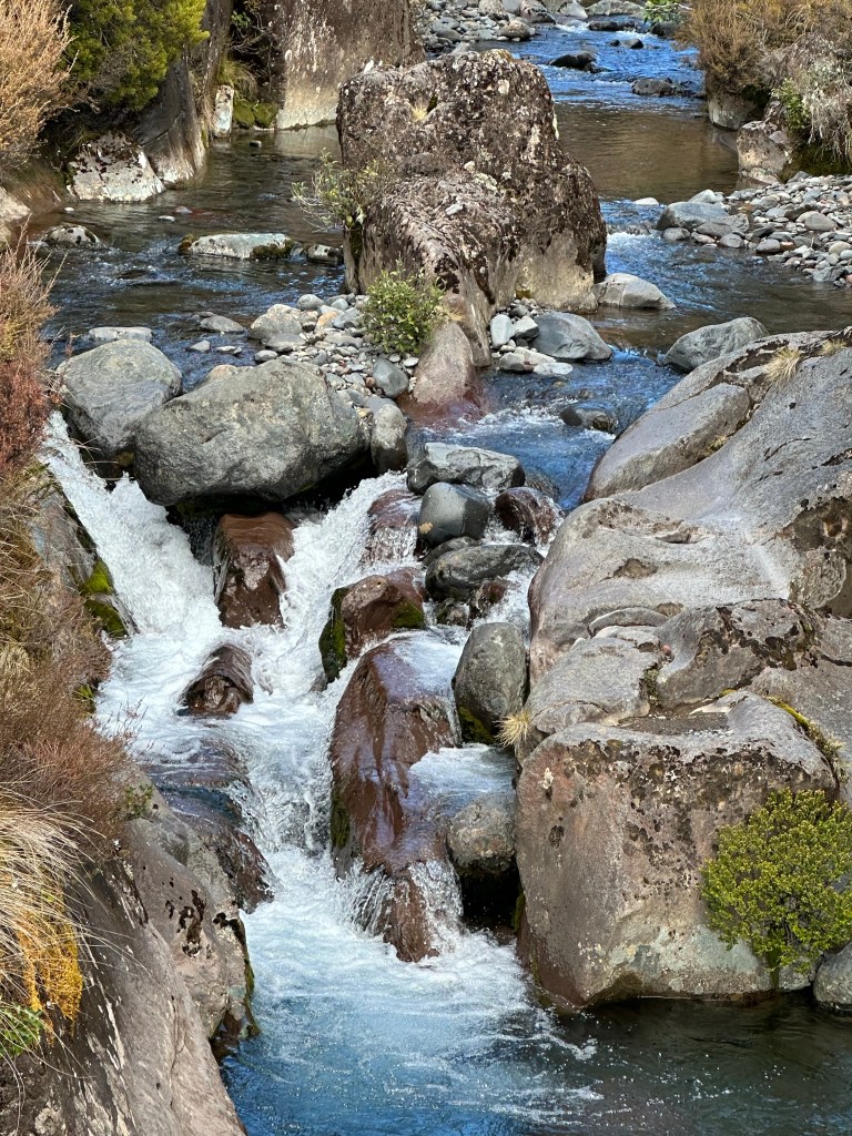
Mineral rich volcanic soils and streams stopped me with admiration and I am happy to be here, doing this, I don’t have to do the Crossing to be fulfilled. Up river, the silica rapids appeared; milky with sediment, flowing from the powerful hillsides. The rapids were smaller than I thought they would be but impressive nonetheless.
There were two directional signs at the rapids; one to Whakapapa Village, where I had started, and one to Bruce Road. I hadn’t seen any other turn offs and it didn’t seem right to go back the same way I came given as this is a loop track so I figured it had to be the Bruce Road direction to loop back around. I will confess that this moron left the actual trail map in the car so all I had was a picture of where all the trailheads were, not the full trails. Such a rookie maneuver.
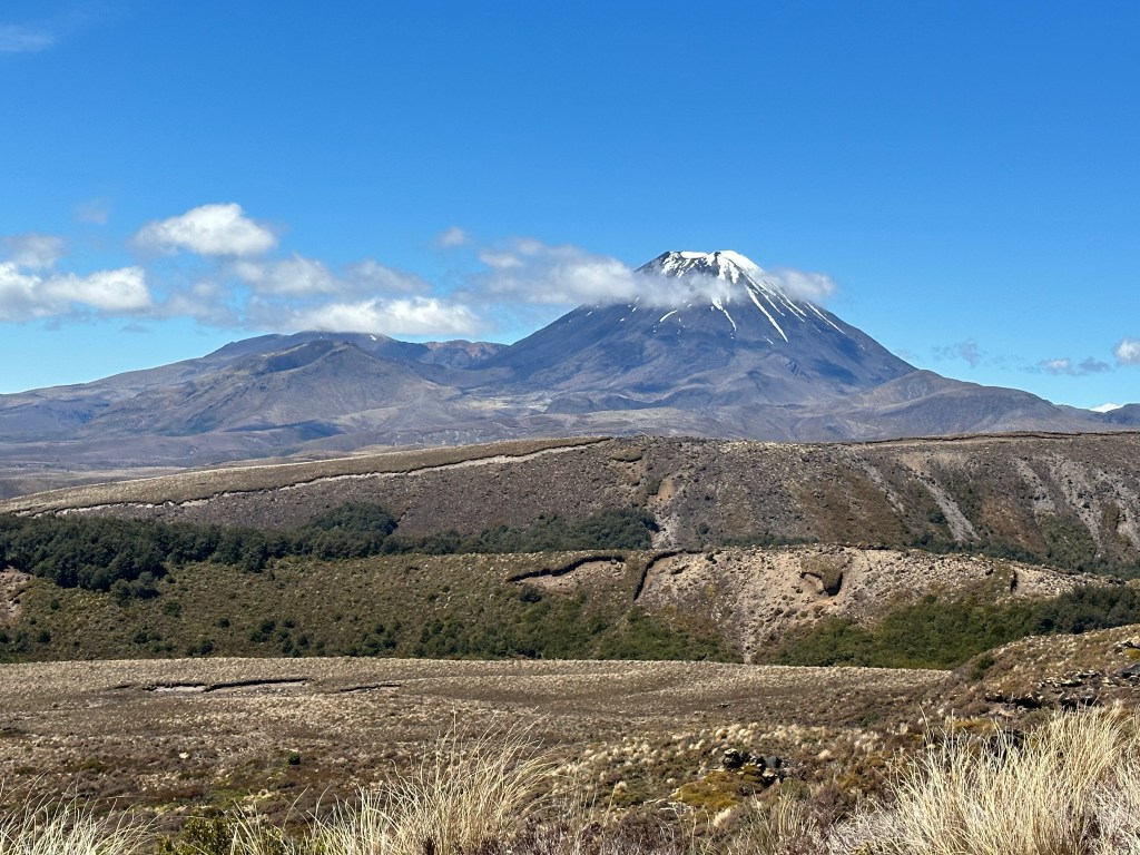
The trail led me further up the mountainside and to my glorious surprise there she was, my beautiful Mount Ngauruhoe. This was the volcano, (if you know Lord of the Rings it is Mount Doom), that I approached five years ago doing the Crossing and, as I climbed closer and closer to her, feeling the power of the earth helped me feel the power in myself. I fell in love with myself and that mountain that day. I know it may be weird to have a favorite mountain/volcano but I do and Ngauruhoe is it. My first time setting eyes on her this trip and I was elated.
I kept hiking, constantly stopping to admire her. I noticed a man, hiking alone with no pack or any type of equipment at all, moving up the trail at a pretty rapid clip. The fact that he seemed unprepared made my spidey sense feel a little funny and as he approached I started recording on my Meta glasses. It gave me an odd sense of security to have this essential dash cam on my face. I didn’t need it though, he said hello like most hikers do and passed without incident.
Scrutinizing the trail ahead in the wide open landscape I was feeling less convinced that I had taken the correct path. Even though I didn’t have service I have my google maps downloaded and was able to do some mapping based on where I was and my projection of where it looked like this trail led. I could see a road below, that was Bruce Road. WIth some quick map handiwork I realized that if I followed this trail to Bruce Road I would then have, at minimum, two miles along the road to get back to the trail head where I started. I pulled up the trail descriptions again. Goodness I’m a moron sometimes, Silica Rapids isn’t a loop, it’s a return. I was supposed to have gone back the way I came. But that’s ok, this was worth it for the treat of seeing Ngauruhoe. Even if it did mean I do now have to go back up the steep steps on which I had just gloated about the fact that going down them wasn’t bad but man it would suck to go up them.
I turned on my heels and ended up doing just that in due time, going up those steep stairs. And going back past silica rapids, and back down the original trail from whence I had come. By this point I had to pee and you know what doesn’t help when you have to pee? Being alongside a river and hearing running water the entire time. I finally found a spot that had a little area where I could hide at least a bit from the trail and take care of business. I’ve hardly seen anyone on here anyways. But of course, at the most opportune time an older man with a younger woman came by and looked all around to find their way as this was also a fork that split off to another trail. I had attempted to use a pee funnel again because squatting with my healing quad sucks and, well, I am not ashamed to admit that I have now peed on myself in three foreign countries. Thank god I also keep body wipes in my pack. My days of attempting to use any type of pee funnel are officially over.
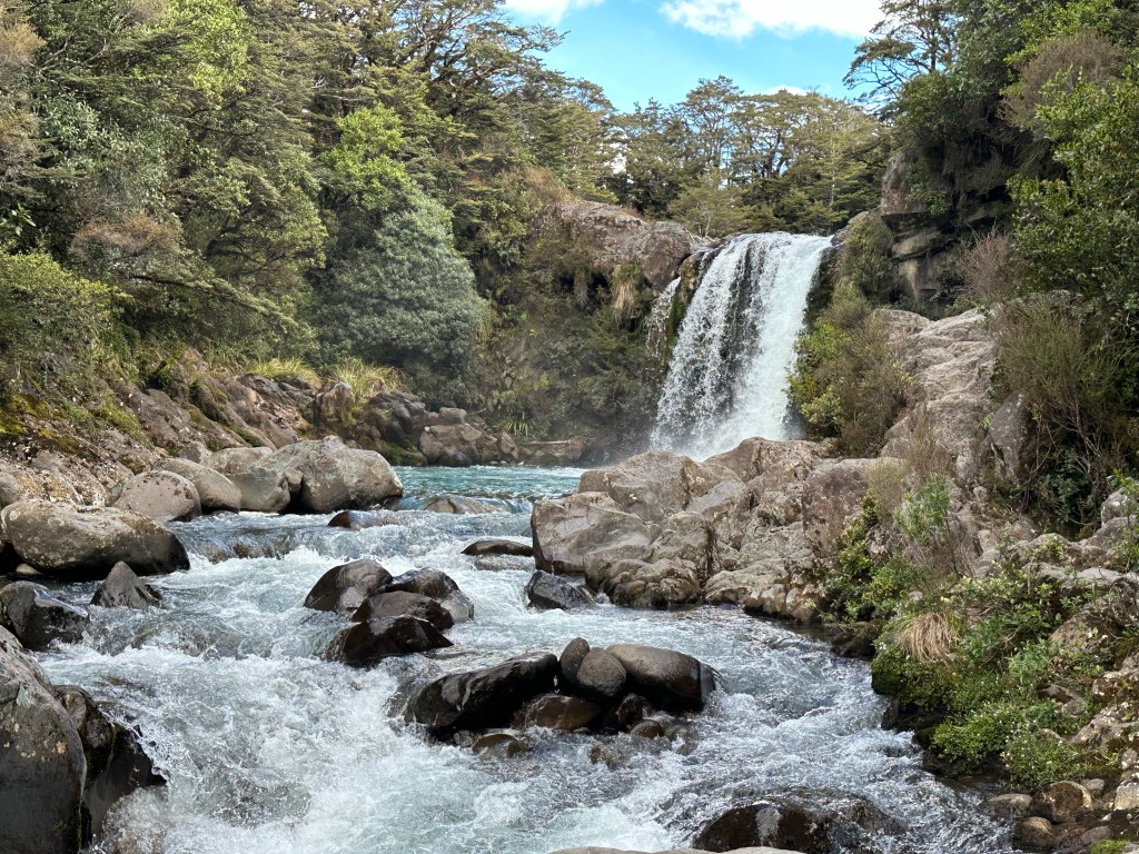
My little wrong turn made a 7km trail into a 7 mile trail but I don’t mind one bit. Off the Silica Rapids track I stopped at my car to get the trail map and refresh water before walking down the road to the start of the Taranaki Falls trail; a two-hour loop past, you guessed it, Taranaki Falls. I double, triple, quadruple read the map and description to confirm it was, in fact, a loop.
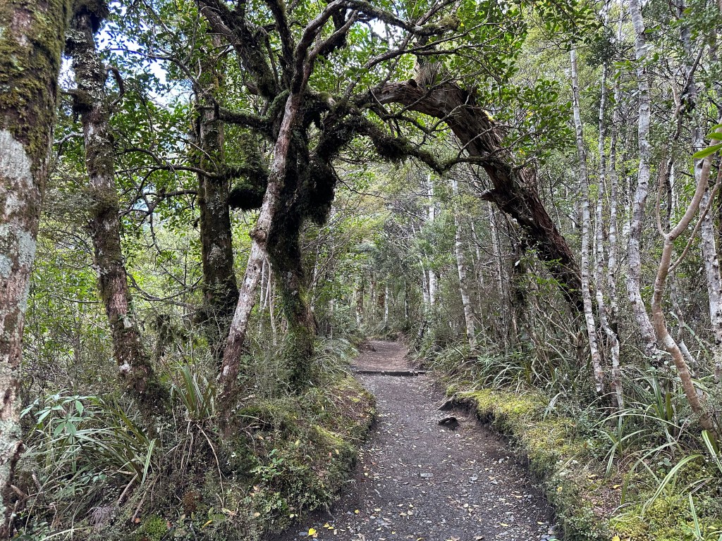
The trail started in tall shrubby bushland and wound in and out of forest patches before following alongside the river up a longer stretch of rainforest, and then popping back out into shrubby bush. Ngauruhoe came in and out sight as the trail wound. A bridge crossed over the river with a tease of a smaller waterfall cascading beneath it.
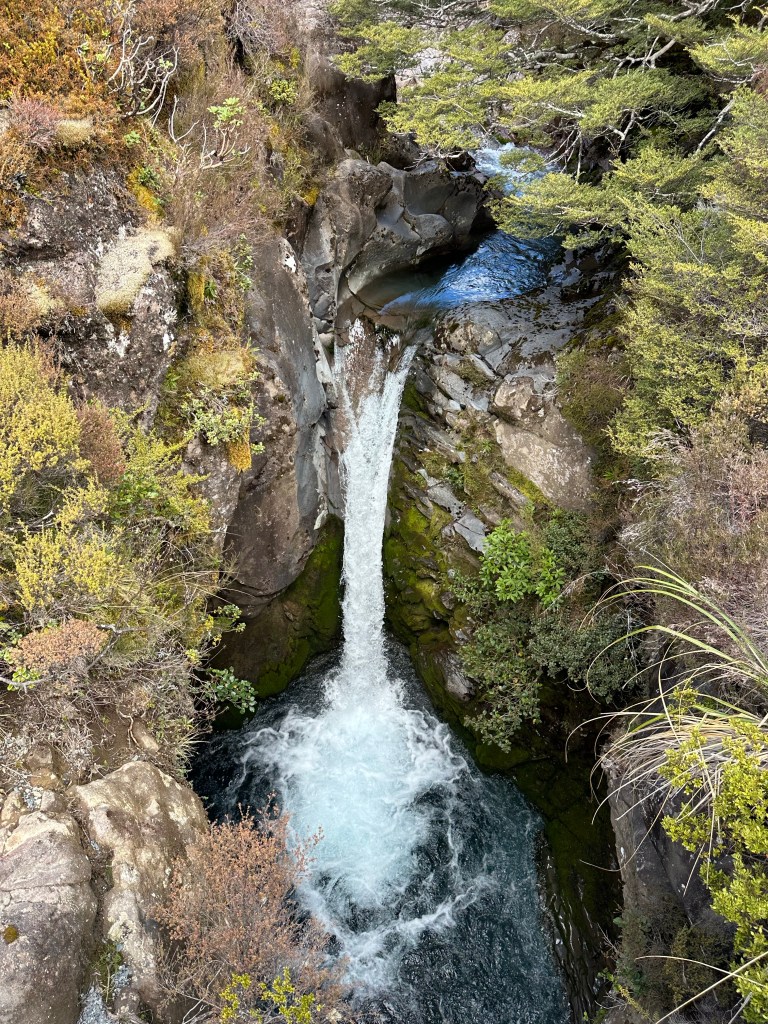
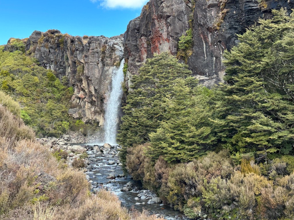
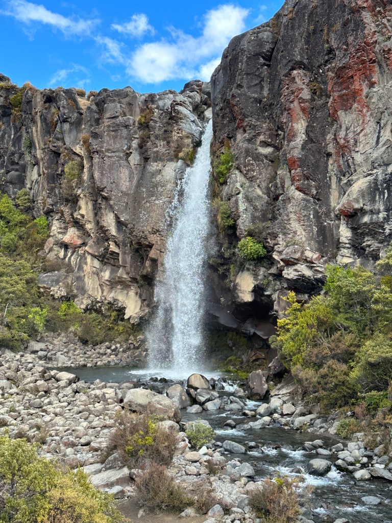
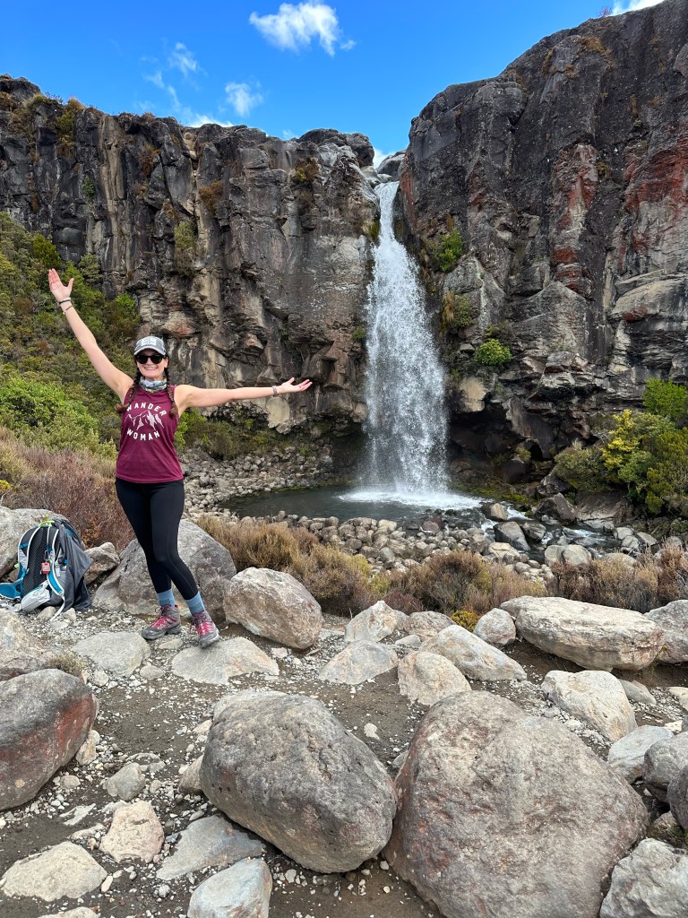
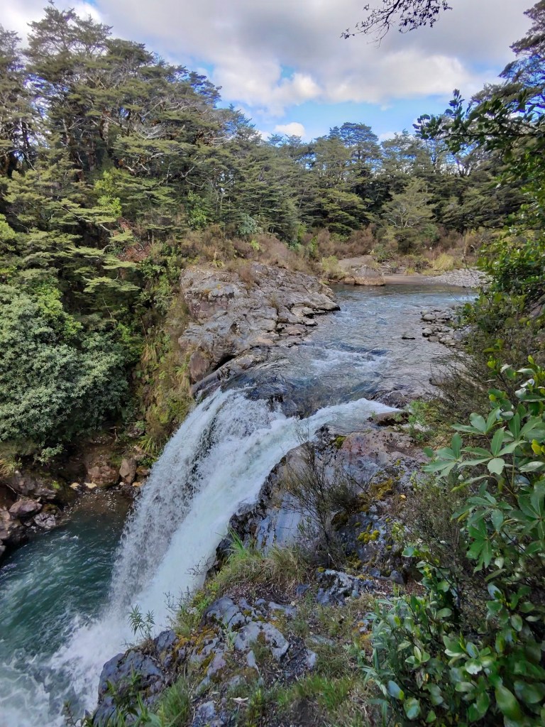
After a final climb, Taranaki Falls blasted down into a shallow pool. It is important to know that in Tongariro the streams, lakes, rivers – basically all the bodies of water – are considered sacred to the Māori and out of respect visitors should not touch or enter the bodies of water. Knowing this I was super annoyed to see tourists blatantly climbing down the rocks to get behind the waterfall. In all fairness, there is not much signage about this and if you are not an English speaker I do understand that it would be hard to realize you are making this faux pas. I asked a German lady who was giddy playing photographer with her own people if she wouldn’t mind snapping a picture of me. She gladly agreed and made it seem as though she was snapping a ton of shots and even taking a pano but when I got my phone back I realized she didn’t know what she was doing and only snapped two; but one was really good so again I’ll grant a pass. That’s one thing about traveling alone; taking a little cell phono tripod (also in my pack and that I used earlier at Silica Rapids) and not being afraid to ask people to take your picture is key if you want memories of yourself that aren’t just selfies.
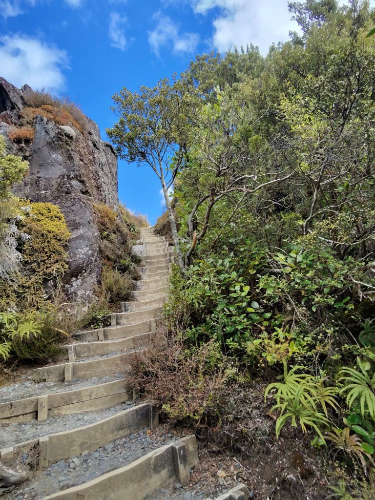
Leaving the falls, the loop tracked even higher and more trail steps took my breath away as I told myself how great of a workout they were for my booty and legs. Functional training at its finest. Finally reaching the ridge there was a set of trail toilets. Let me just say that I would rather pee on myself again than use that nasty trail bathroom again.
On the ridge, I was shocked to see how small of a stream feeds the waterfall; I would have expected a much greater river for the power that was behind it. I veered off the trail onto the rocks and climbed out to the top of the waterfall, careful not to touch the water or get close enough for a slip and fall. I wish I was more impressed with waterfalls. I do think that they’re pretty and all that jazz but I’ve just seen so damn many in so many countries that they don’t particularly awe me any more. Maybe on a hot day with a fall feeding into a good swimming hole?
The rest of the loop back was mostly through low brush and very exposed. Biting winds on flat ridge snapped at my face; so thankful I’ve applied moisturizing sunscreen on repeat today. I ended up behind a group of five that were going soooo slow and taking up the entire width of the trail, not caring that I was behind them. I felt like I was stuck in a traffic jam and my annoyance was growing. A muddy section finally caused them all to go single file to try to move around the side and I jumped on this opportunity to splash right through the mud and pass them. Solid trail boot flex!
With a bit over 11 miles of hiking under my belt this afternoon I wasn’t quite ready to be done but it was getting colder out and I did need to make sure I found food before everything closed up. I made the responsible decision to stick to just one more super short walk instead of starting on another real trail. Tawhai Falls are right off the road the walk is described as a 20 minute return but in fact I think I was there in about five and even after taking a few minutes to enjoy the peaceful river was back at my car in closer to 15 minutes. An underwhelming trek to end the day.
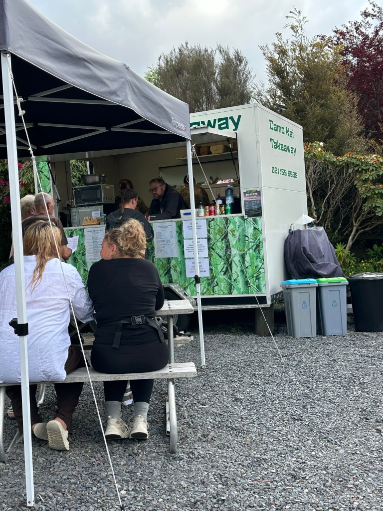
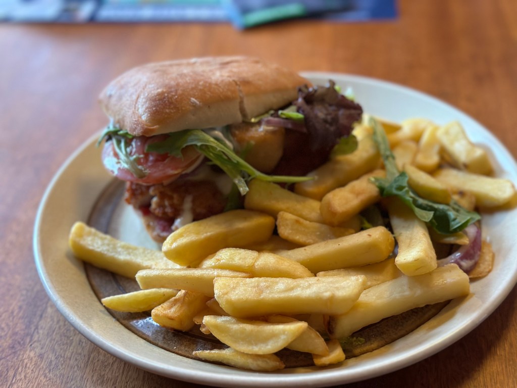
With enough cell reception to search for food I found that I had two options between me and my AirBnB and drove off towards The Spiral Restaurant; only to get there and find a sign that they were only serving in-house hotel guests tonight. With my chance for a solid sit-down meal crushed, my remaining option was Camokai Takeaway. I navigated a couple streets down and found the stand, like a mini food truck trailer. A chicken & camembert burger with fries would have to do. I waited a solid 20 minutes, freezing in the chilly wind, for my takeaway order and, as hungry as I was, decided to take it back to my AirBnB instead of eat on the little picnic tables there because of the cold. The burger was good but the fries were marvelous. I realized that the wait time is due to cooking everything to order, each potato cut and fried with each order.
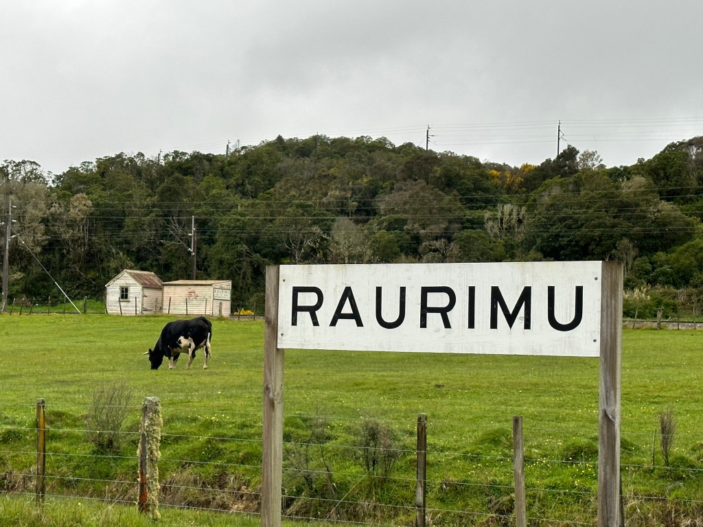
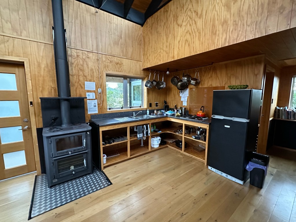
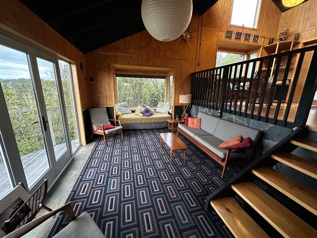
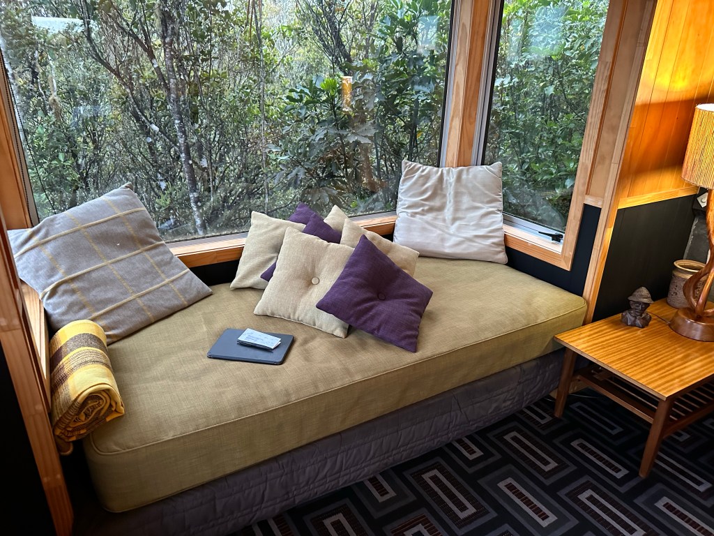
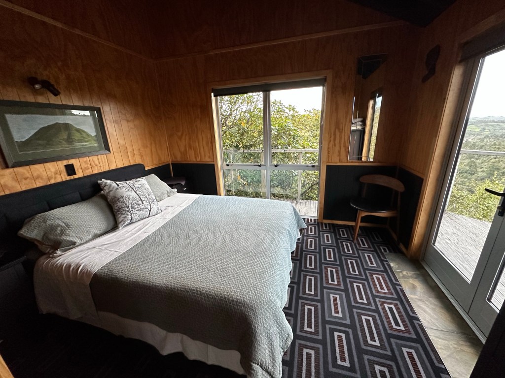
For the next three nights I’m staying in Raurimu in the Tree House at Wood Pigeon Lodge. The Lodge is a private land on which the owners built three distinct AirBnB properties. Bunnies scattered all over the road as I drove through Raurimu and up the windy dirt road at the edge of town to fully self sustainable treehouse cottage.
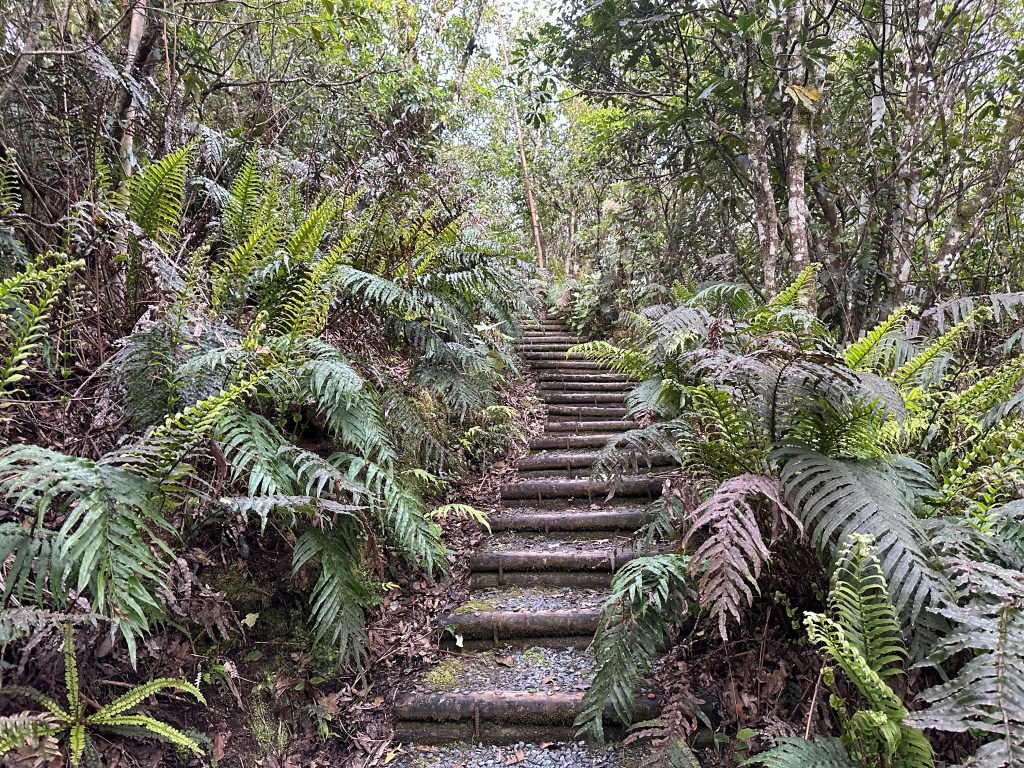
Walking up the 54 steps cut through the forested hillside I wasn’t so sure what I had gotten myself into but this place is adorable. Even if all the signs and warnings about not running out of electricity or setting the place on fire with the wood heater and stove are a bit terrifying.


Leave a comment