I slept great last night! I never did get a heat source going but the bedding was warm and cozy. Though I did almost kill myself coming down the spiral staircase to use the compostable toilet in the middle of the night.
I was too tired to get around to planning my day before falling asleep last night so first thing this morning I pulled out my iPad and little ideas list and started planning. I was originally to stay in Reefton tonight but after having knocked out Abel Tasman yesterday I didn’t really need a go-between stop. So I got on AirBnB and found a place in Greymouth instead. This turns today into a much longer driving day but turns tomorrow into a super short driving day. And based on the areas it makes the most sense.
I was anxious to hit the road but decided to wait until the Jester cafe next door opened at 9am so I could get my free breakfast. One thing I am working on this trip is slowing down a little bit. We’ll see how long it lasts but, trust me, waiting to eat a proper breakfast instead of just chowing down on a protein bar and hitting the road is a big step for me. Plus, their goat tangine was soooo good yesterday I figured I had to try their breakfast specialty, the Hash Brown. It was good but I totally would have eaten the goat tangine again. Over breakfast I finished sketching out the day and off I went!
First stop on the agenda today was the Fox River Caves. But I had about 3 1/2 hours to go until I got there. About half an hour into my route I saw a gas station and pulled over to top off my little chariot. That turned into an adventure in and of itself as the unmanned petrol station would not take my credit card without a PIN – ugh, I had this problem in Iceland as well. Fun facts, you can’t get PIN numbers anymore for credit cards with chips. I didn’t know how long it would be until I found gas again. Luckily I was able to dig out my debit card and that worked. And I’m so glad it did; I paid attention, I did not see another gas station for about four hours, I think I would have ran out of gas.
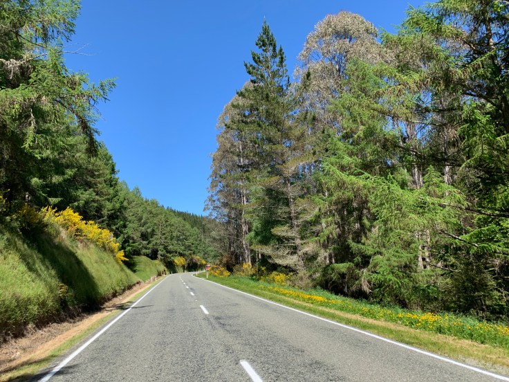
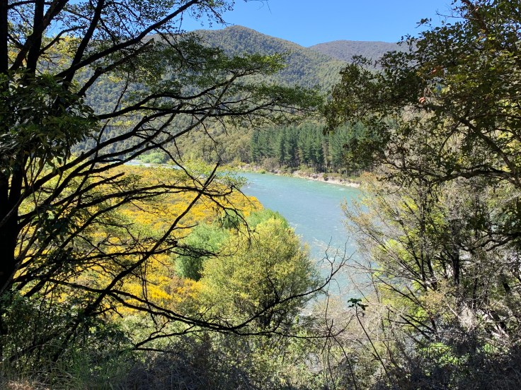
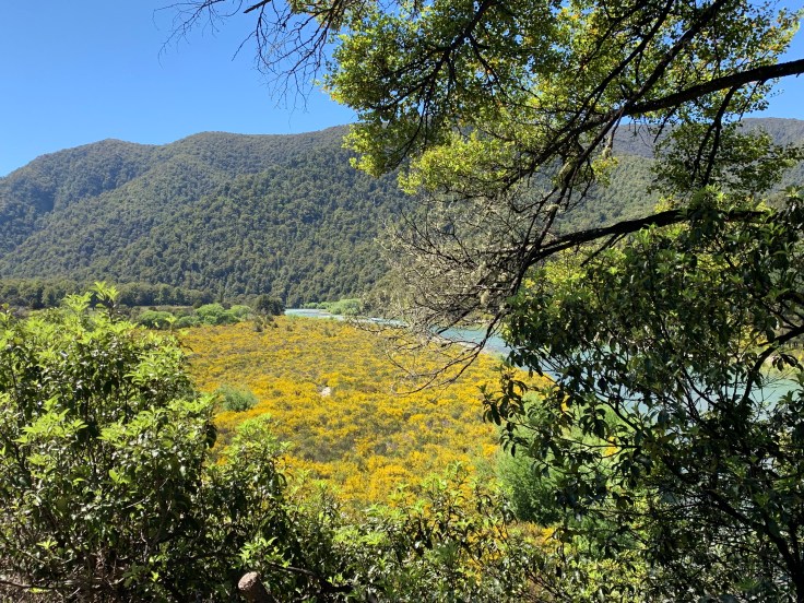
After gassing up I popped open one of the bottles of Bundaberg holiday spice ginger beer I had picked up the day before (never fear, this is just ginger “beer” – not like an alcoholic beer) and holy smokes it was amazing! I already love ginger beer but add in some cloves and cinnamon and it took it to a whole new level! I hope they are selling it in the U.S. I sipped my ginger beer and enjoyed the scenic views around me. The drive was absolutely gorgeous, and while windy, was not nearly as curvaceous as I feared. The first roughly three hours of the drive took me through gorgeous national parks winding along the Motueka River. The peaks and valleys were lush and green. An abundant yellow flowering bush accented the hillsides throughout. Also throughout were multiple single lane bridges where one must make sure you aren’t paying chicken with oncoming cars. Those are always fun. This interior highway would pop me out on the coast and become the scenic coast highway.
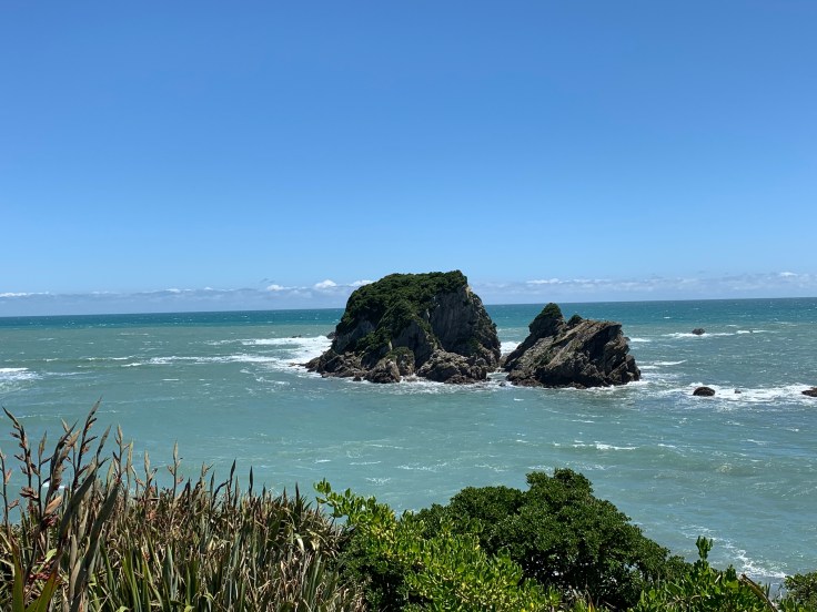
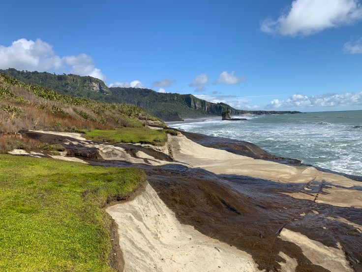
As the highway turned along the coastline I saw sign for the Cape Foulwind lighthouse. This would not have even been on my radar but I remembered my friend Kyra suggesting the lighthouse’s accompanying trail from her adventure here earlier this year. I veered off the main highway and followed the little side road. There were two options for picking up the trail. Either at the lighthouse itself and then you follow it down to the seal colony and back. Or vice versa. I decided to start at the seal colony. Cape Foulwind was gorgeous but aptly named, I had to fight at times to keep my beloved hat on my head. The trail was an easy one. The seal colony was not much of a colony though. The seals camouflage really well with the rocky terrain. Unimpressed I tracked on. In the end I stopped short of making it all the way to the actual lighthouse. As I was getting closer to it I didn’t feel an overwhelming need to inspect it firsthand and I was very conscious of the time as it was already past 2pm and I had a number of other sites I wanted to try to find today.
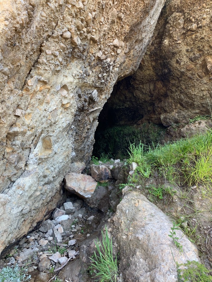
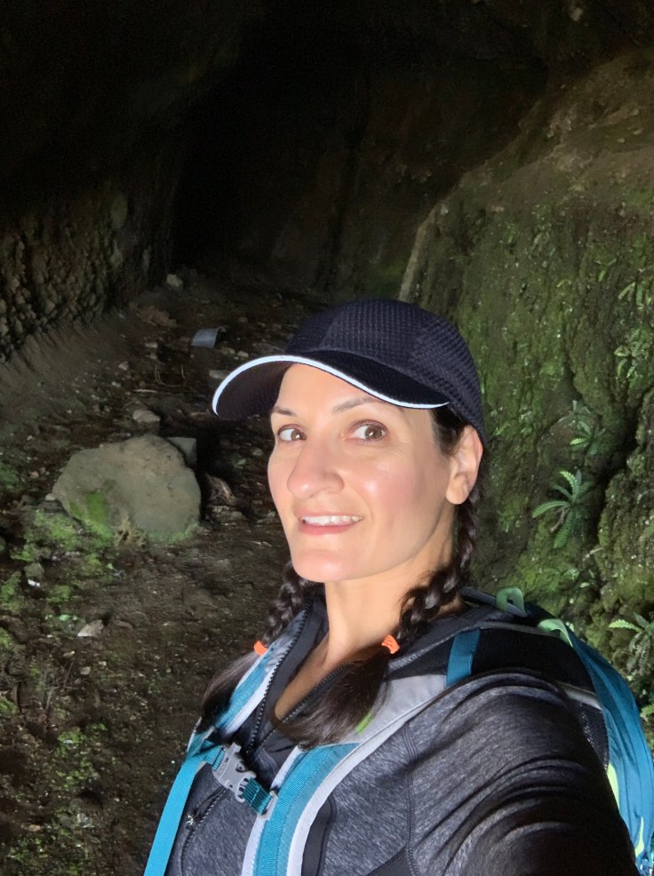
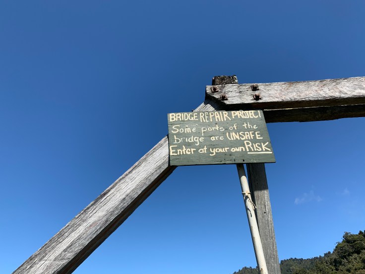
 About 40 minutes later I arrived in Paparoa National Park and made it to the car park for the Fox River Caves. Only I couldn’t find any mention of the caves at all. What I did find was a trailhead for the Inland Park Track – actually the technical finish of the track. I looked around befuddled and gave up. As I was pulling out of the car park thought I spotted a little bridge and what looked like it could be a cavernous shadow. Jackpot! I pulled back over on the side of the road and voila, I had find the historic Fox River bridge and cave. I had read that the cave was right off the road and sure enough there it was, just across the little bridge. I jumped down an embankment at the end of the bridge and found myself at the opening of the cave. It was a cave, dark with water dripping down. I ventured into it and went about halfway through and decided that was good enough. Getting back up the bridge was fun. That little embankment I jumped down… well what goes down must come back up (talk about a good metaphor for life huh?!). It was only about 4 1/2 feet tall but a vertical ledge. I managed to get one foot up into a little crevice and hoist myself up, a little skinned knees never killed anybody. Walking back across the bridge I noticed a crude sign that the bridge was under repair and could be dangerous. Probably best I didn’t see that sign on my initial crossing.
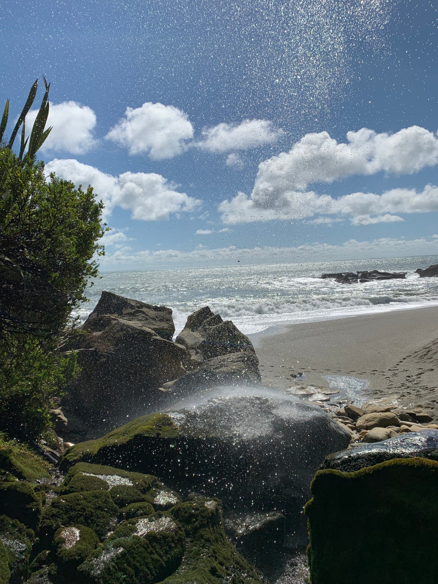
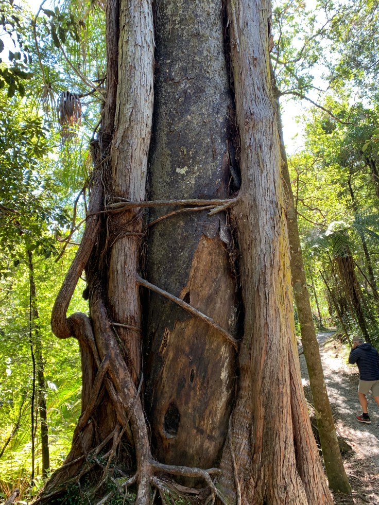
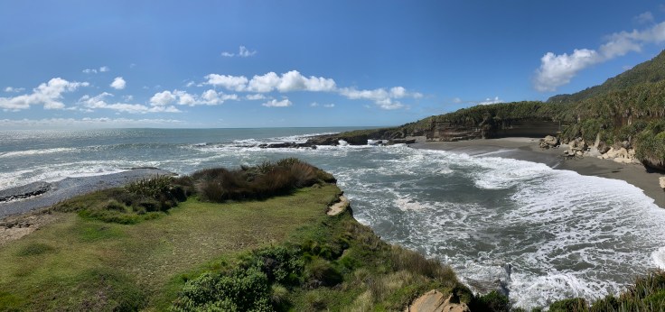
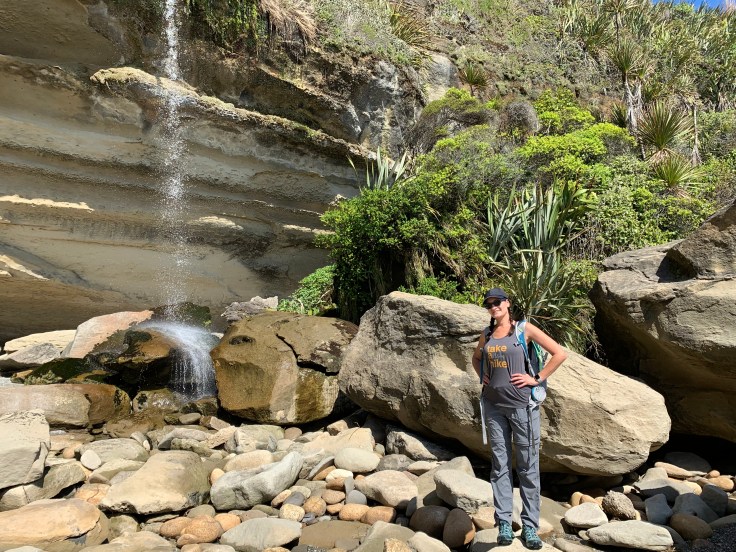
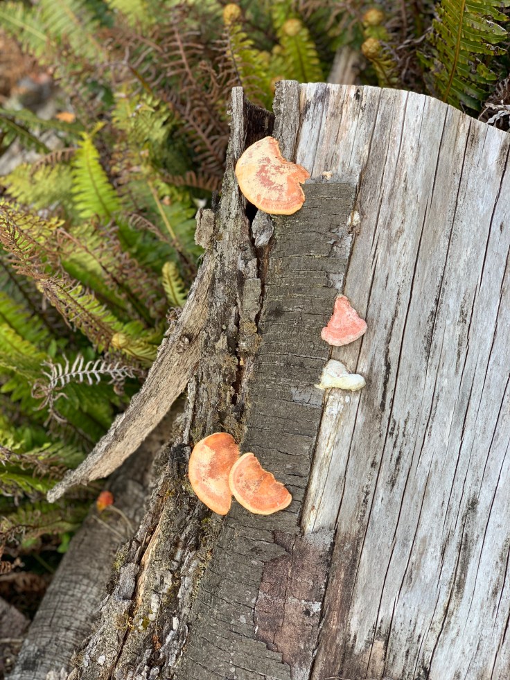
From there I made my way to the Truman Track. A short path from the highway down to the water’s edge through the lush forest. I saw some fascinating tree formations where the trunks looked like they were being consumed by other trees. This little track was decently congested and the lack of trail etiquette was frustrating. When the trail popped out onto the coast it was gorgeous. The cool misty breeze spraying light saltwater across my skin felt divine. A sign let me know that penguins nest here but still none were to be seen. Apparently they only come ashore around dusk and dawn to feed their babies. I’ll have to google if there are supposed to be any on the beaches near me tonight and maybe an early morning trek is in store for me. There was a little waterfall on the cliff against the beach and I climbed all the way down the trail and dodged waves across the beach to reach it. This beach was more pebbles than sand and my feet sank into the wet gravelly ground – which was perfect because it cleaned all the muck from the shipwreck yesterday off of them! The little inlet was beautiful. I was alone down there save for two other people. I exchanged picture taking with the couple and watched the waves crashing before heading off to my next destination.
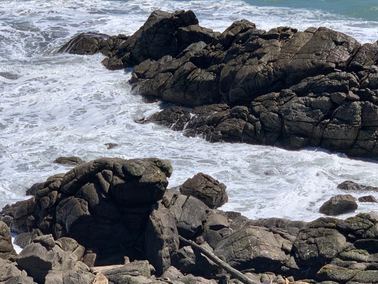
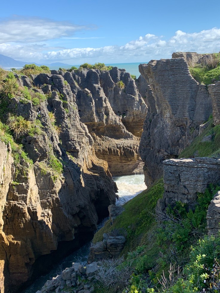
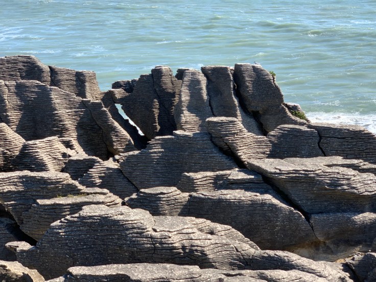
 A few minutes down the road I arrived at Dolomite Point to see the famed Punakaiki pancake rocks and blowholes. These exquisite rock formations are layers of limestone and it is still a mystery to science how they came to be formed in layers. The 20ish minute track amongst the rocks was pretty heavily occupied but it was still beautiful regardless. Nature is awesome. I stopped for a few minutes and watched the waves crash in and explode between crevices in the formations.
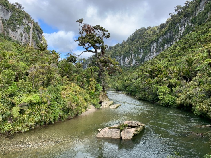
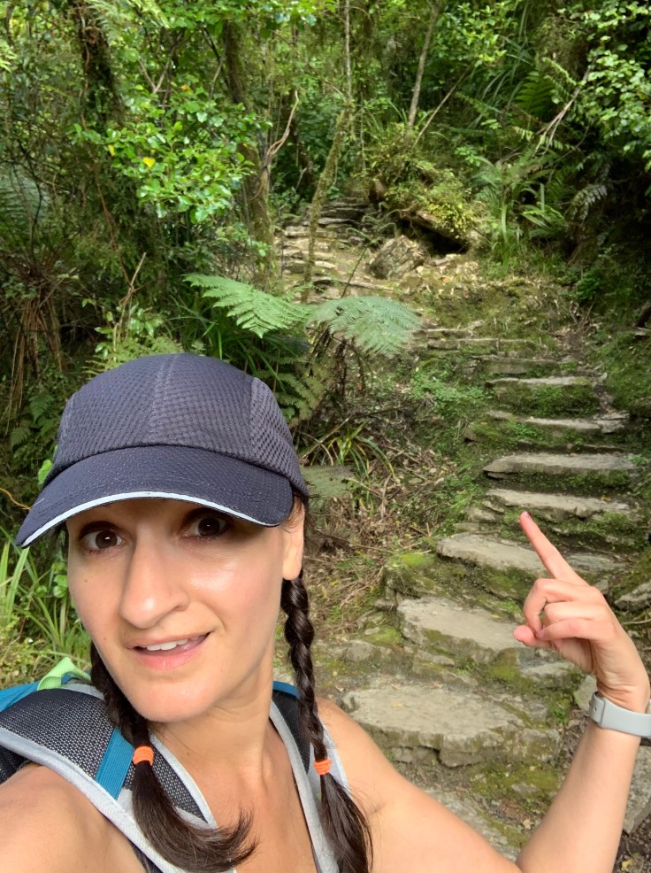
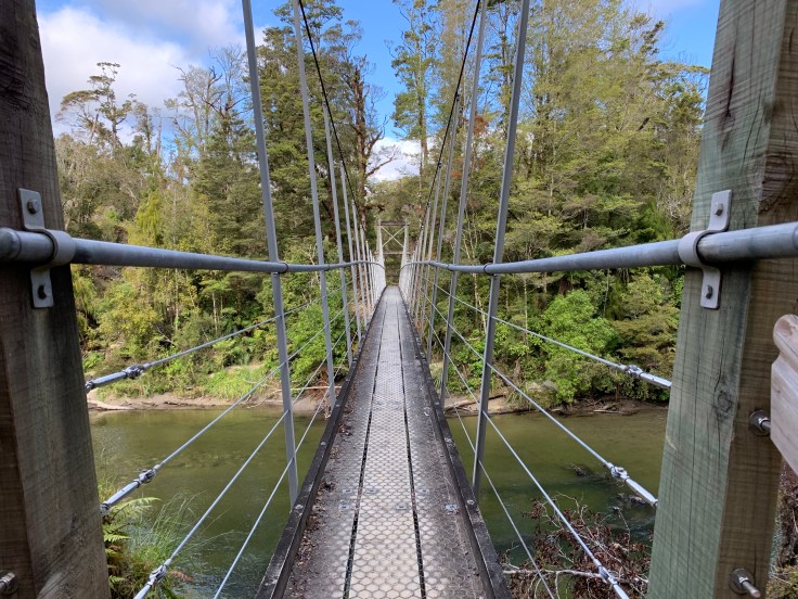
Now it was time to do some real hiking. I found the trailhead for the Pororari River Track and off I went. The Paparoa National Park has a very impressive trail system and this particular section winds along the beautiful Pororari River. It would be a down and back hike since I wasn’t sure how I could get back to my car from the other end of the trail but that was fine by me. From the moment I stepped onto the trail I was in awe of the lush forest surrounding me and the beautiful stone formations overhead. The trail itself had beautiful views and was interesting without being overly challenging. At one point there is actually a little tiny cave that the trail takes you through. Coming out the other side of the cave I momentarily forgot about my terrible depth perception and almost ate it trying to get down some stone steps. Oops. I made it to the end of the trail and decided to go a little further onto the connecting Inland Park Track to find the swingbridge I had seen on the trail map. Plus I was doing pretty good on time. I found the swingbridge and it definitely swung when I walked across it! A little gust of wind didn’t help either! I decided to go a little further into the Inland track but after a few minutes realized it wasn’t nearly as pretty as the river track and I did have over an hour hike to get back. I considered my timing and decided to turn back. At this point I wouldn’t get back to my car until close to 7pm and I still had another 40 minutes or so get to my AirBnB for the night.
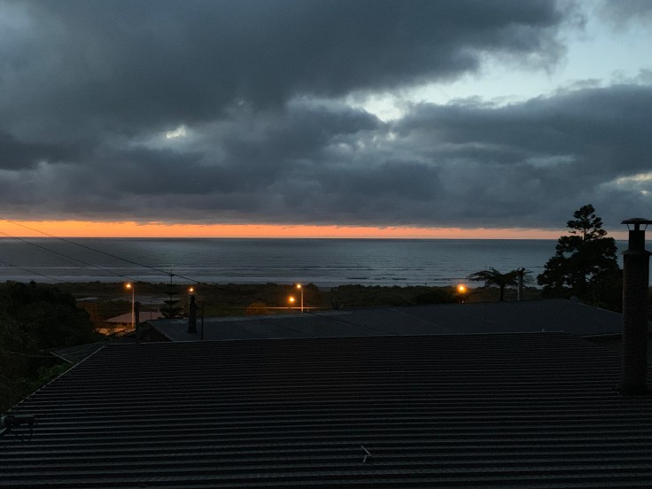
The hike back went very quickly and before I knew it I was back on the road. Turning back onto coastal highway 6 and heading towards Greymouth for the night I started noticing that quite often the speed limit was different in each direction! Fascinating. It was still bright out but a fog was starting to come in from the mountains and the earth had an eerie haze about her as I drove on. I arrived in the sleepy little town of Greymouth and found my AirBnB. Whereas my place last night had oodles of charm to spare, this place, well, it could use some… BUT it does have a washer AND dryer which is nice because even though I’m only just ending day two there was a decent amount of dirt and mud involved today. Not to mention it has a toilet that actually flushed and an ocean view!
It was about 8pm by the time I got into my AirBnB and I needed to find food. A quick google search however was not promising. The South Island is mostly really small towns, including Greymouth, and almost everything was closed by 8pm! I was lucky to find an ale house where I could get a grilled chicken sandwich and an awful side salad. I would kill for some romaine or iceberg lettuce right about now.
Today was a pretty decent day. I feel like I’m starting to settle into the trip which is always a good feeling. Worth noting – if you ever travel download the offline version of maps into your google maps! I basically had no cell connectivity today and having those offline maps saved my bacon! Most of the stuff I did today I had on my list for day three activities which means now I can find more activities near Hokitika for tomorrow! While today was a monster of a driving day now tomorrow is a super short driving day which will be great; less time in the car and more time to explore!

Wow! You are fearless, my Lovely Daughter! So happy to see you in your element.
LikeLike
Once again I’m amazed by your braveness and thrill for adventure. Be safe! Danelle,
lots of love!
LikeLike